What is the difference between a frost and a freeze?
The dew point and wind conditions impact how likely a freeze will be damaging. Cold, cloudy windy conditions can limit damage.

I am trying to train myself to stop saying frost when I mean freeze. They are not always the same thing. A frost is when we get a visible frost. A freeze is when the air temperature drops below freezing. Sometimes we get frost when the temperatures are above freezing and we often have a freeze without frost. It all has to do with the amount of water in the air.
There are two different ways to measure humidity, the amount of water vapor in the air. The one that most people use is the relative humidity. The relative humidity measures how much water is in the air compared to the maximum amount of vapor the air can hold. When the air cannot hold any more water it is saturated and the relative humidity is 100 percent. Warm air can hold more water than cooler air. So during the day and night the relative humidity changes as the temperature rises and falls. If the temperature falls far enough, the amount of water in the air is more than the air can hold at that temperature. The air is saturated and water vapor in the air condenses as water on surfaces such as our cars, the roofs of houses or on lawns as dew.
The dew point measures the absolute amount of water in the air. It is the temperature at which the air is saturated and the relative humidity is 100 percent. So for a given volume of air with a set amount of water vapor in it, the relative humidity varies with the temperature, but the dew point is always the same.
What does that have to do with frosts and freezes? It all has to do with the dew point. If the dew point is much above freezing a frost is unlikely. The higher the dew point is above freezing, then freezing temperatures are less likely. If the dew point is below freezing, then a frost becomes more likely. Dry air heats and cools much more quickly than humid air. Water vapor in the air acts as a heat reservoir absorbing heat.
If a dry air mass moves into the region, a freeze is likely. Dry air has a low dew point and a low relative humidity. The dry air warms quickly during the day but also cools quickly at night. If we have clear calm conditions the ground cools rapidly at night by radiating heat away to the open sky. As the ground cools, it cools the air next to it. If it is windy, then this cool air is mixed with warmer air above and the warmer air warms the ground. In calm conditions, the ground continues to cool. The ground becomes colder than the air. See What are Radiation Freezes?
At the dew point, water vapor in the air condenses on the ground and other surfaces as dew. If the dew point is below freezing, the water vapor condenses as ice, freezing as frost. So the air can be above freezing and the surface of your car (or the roof of your house) can be colder than the air and colder than freezing causing a frost even though the air temperature is above freezing. That is how we get a frost without a freeze. If the dew point is much below freezing then we can get freezing temperatures cold enough to freeze plants without any frost. This is also called a black frost, a freeze without a frost. When frozen plants thaw they have a water-soaked, black appearance as they die.
Sometimes we get a freeze under windy conditions. This is caused by the movement of a cold air mass into the area with subfreezing temperatures. These freezes are called advective or wind freezes.
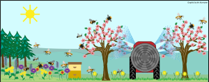
Most of the freezes that cause problems in the spring in Michigan are radiation freezes. These freezes occur after the passage of a cold front, which precedes a mass of cool dry air. Usually there is a stormy period as the cold front moves through followed by clearing and light winds. During the night the ground cools and chills the air above it. This layer of cold air becomes thicker and thicker so that cold air is close to the ground with warmer air above it. Normally warmer air is located closed to the ground and the air temperature falls as you rise upward in the atmosphere. In a radiation freeze this is reversed and cold air is located close to the ground with a warm layer above it. This warm layer is called an inversion. Wind machines are used to protect plantings by mixing the warm air above with the cool air close to the ground. The effectiveness of the wind machine depends on whether the warm air layer is close enough to the ground for the machine to reach. Often you will hear that the inversion is high or low describing the relative height of the inversion.
Types of Freezes
|
Radiation freeze |
Advective freeze |
|
Winds less than 5 MPH |
Winds higher that 5 MPH |
|
Clear sky |
May be cloudy |
|
Cold air mass 30 to 200 feet thick |
Cold air mass 450 to 3,000 feet thick |
|
Inversion develops |
No Inversion |
|
Cold air in the low spots |
|
|
White or black frost damage |
|
|
Easier to protect |
Difficult to protect |
Long ago when fuel was cheap, orchard heaters were used to heat fruit plantings. These were very effective when the inversion was low. Fuel prices are now prohibitive for heaters but wind machines remain effective and work best when the inversion is low.
Another effective way to add heat to a planting is to use sprinklers to either cover the plant in ice, keeping the ice wet and maintaining the temperature of the plant inside right at freezing and preventing injury. Sprinklers are also used in orchards under the trees or under wind machines to release heat as the water freezes warming the orchard air. These freeze control measures can work well under the calm conditions of a radiation freeze.
Related articles
- What are Radiation Freezes?
- Analyzing and improving your farm’s air drainage
- Air moving fans for improved air drainage
- Moist, weed-free soil retains more heat
- Using sprinklers to protect plants from spring freezes
- Protect blueberries from spring freezes by using sprinklers
- Freeze damage depends on tree fruit stage of development
- 2013 bloom dates for southwest Michigan tree fruit crops
- Using Enviro-weather’s regional overnight temperature report during cold events
- Probability of a hard frost or freeze in the spring for some southwest Michigan fruit sites.


 Print
Print Email
Email


