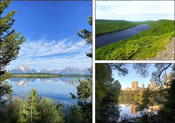
MSU researchers catalog 480,000 lakes in the lower 48 states
A team of Michigan State University researchers is on a mission to help ensure that current and future generations can enjoy the nation’s lakes.

As summer temperatures increase, many people may seek refuge at a favorite lake. Such traditions are particularly prevalent in places like Michigan, home to thousands of lakes.
A team of Michigan State University researchers funded by the US National Science Foundation is on a mission to help ensure that current and future generations can continue to enjoy and create memories with lakes, both in Michigan and nationwide.
This team, led by Professors Kendra Spence Cheruvelil and Patricia Soranno in the Department of Fisheries and Wildlife, is taking a unique approach. Rather than studying a few lakes in their local area or state, they sought to uncover broad patterns across all the different types of lakes in the lower 48 states, from Michigan to Maine to California to Florida. This large-scale approach is important for the effective management of the nation’s lakes in light of the widespread pressures affecting lakes, from land-use alteration to climate change.
Cataloging lakes may sound intuitive and easy, but it turns out this is no simple task. Defining a “lake” can be particularly complicated. For example, is a lake the same as a pond? Are reservoirs with dams considered lakes? The MSU team defined a lake as a permanent waterbody of relatively still water at least 1 hectare in size, with or without dams or other shoreline alterations. Therefore, lakes, ponds and reservoirs are all considered lakes, and those can be differentiated from faster-flowing streams and rivers, and smaller and shallower wetlands.
Using this lake definition, the MSU team compiled existing data for 479,950 lakes across the lower 48 states. These lakes and their characteristics make up the database LAGOS-US LOCUS -- “LAGOS” means “lakes” in Spanish and “LOCUS” helps users remember that this database links lakes with their locations. This database was recently published online through the Environmental Data Initiative and described in the journal Limnology and Oceanography Letters.
“The most unique part about LAGOS is that all of the data are available online. Researchers around the world can take advantage of this database and its tools to conduct broad analyses of lakes,” said Lauren Rodriguez, MSU’ 20 and team member.
Other than the U.S. Great Lakes, which were not included in LAGOS, the largest lake in the lower 48 states is the Great Salt Lake in Utah at 3,390 km2. The top three states with the most lakes are Texas (43,343 lakes), Florida (35,508) and Georgia (32,664 lakes). Michigan is 7th with 15,905 lakes, whereas Delaware is 48th with 540 lakes.
“People often guess that Minnesota has the most lakes of any state, but it’s actually fourth," said MSU postdoctoral researcher and team member Ian McCullough. "People probably think of the 10,000 lakes license plates, but Minnesota has 29,669 lakes greater than one hectare in size. For the 10,000 lakes license plates to be accurate, they would need to print the caveat that they are only counting lakes greater than 7.67 hectares or change the plate to 29,669 lakes. I don’t know how many of those plates would sell.”
In addition to the lakes themselves, the MSU team also mapped watersheds for these half-million lakes. Lake watersheds contain the land area and tributaries that drain into a lake and are important for determining what lakes might be at risk from land development or agriculture. Unlike lakes, which can be mapped using aerial or satellite images, lake watershed mapping must consider topography and the locations of inflowing streams and rivers. Historically, land surveyors mapped lake watersheds on the ground, but digital maps of topography, streams and rivers enable efficient, computerized mapping of lake watersheds across the entire U.S.
“Having digitally mapped watersheds for every lake in the lower 48 is a game changer,” said Cheruvelil. “This is a critical step in assessing the proportion of lakes across the country that might experience changes in water quality or swimmability in the near future.”
Release of the LAGOS-US-LOCUS database is just the first step for this team. The MSU team, in collaboration with scientists at several other universities, plans to release additional databases that connect with LOCUS and contain information on water quality and watershed characteristics that often influence water quality, such as forest, agricultural and wetland cover.
“We’re really just beginning," said McCullough. “LAGOS is for the whole research community, not just us at MSU. By sharing data and tools, scientists can understand how lakes may respond to environmental change in the future.”
For more information about LAGOS-US-LOCUS and associated data and research, please visit lagoslakes.org.


 Print
Print Email
Email
